Stanford scientists map local earthquake risks from Eagle Ford fracking, Stanford scientists simulated the local risk of damaging or nuisance-level shaking caused by hydraulic fracturing across the Eagle Ford shale formation in Texas. The results could inform a new approach to managing human-caused earthquakes by Josie Garthwaite, May 3, 2021, Stanford News Services
Hydraulic fracturing to extract trapped fossil fuels can trigger earthquakes. Most are so small or far from homes and infrastructure that they may go unnoticed; others can rattle windows, sway light fixtures and jolt people from sleep; some have damaged buildings.
***
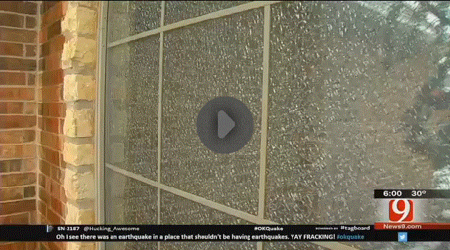
Frac’d window in Edmond OK

Frac’d window in Central Alberta
***
Stanford University geophysicists have simulated and mapped the risk of noticeable shaking and possible building damage from earthquakes caused by hydraulic fracturing at all potential fracking sites across the Eagle Ford shale formation in Texas, which has hosted some of the largest fracking-triggered earthquakes in the United States.
Published April 29 in Science, the results show the most densely populated areas – particularly a narrow section of the Eagle Ford nestled between San Antonio and Houston – face the greatest risk of experiencing shaking strong enough to damage buildings or be felt by people. “We found that risks from nuisance or damage varies greatly across space, depending mostly on population density,” said lead study author Ryan Schultz, a PhD student in geophysics at Stanford.
Social license
Tens of thousands of wells drilled in the vast formation over the past decade helped to fuel the U.S. shale boom and contributed to a dramatic increase in earthquakes in the central and eastern U.S. starting around 2009. Although damaging earthquakes are rare, the authors write, “the perceived risks of hydraulic fracturing have both caused public concern and impeded industry development.” **Tell that to the many families living with significant damages, even after small frac quakes. Dismissing or trivializing the risks as “perceived,” it sounds to me like the oil and gas industry is leading/leaning this study to keep frac’ing and quaking us.**
In sparsely populated areas within the southwestern portion of the Eagle Ford, the researchers found damage is unlikely even if fracking causes earthquakes as large as magnitude 5.0. Allowing such powerful quakes, however, could jeopardize the “social license to operate,” they write. The phrase, which emerged within the mining industry in the 1990s…refers to the unofficial acceptance by local community members and broader civil society that oil, gas and mining operations need to do business without costly conflicts.
“Seismicity is part of the social license for hydraulic fracturing, but far from the only issue,” said study co-author Bill Ellsworth, a geophysics research professor at Stanford’s School of Earth, Energy & Environmental Sciences (Stanford Earth). “Eliminating hydraulic fracturing seismicity altogether wouldn’t change any of the other concerns.”
Among those concerns are health threats from living near oil and gas wells and greenhouse gas emissions from fossil fuel production and use. California’s recent announcement of plans to stop issuing new permits for hydraulic fracturing by 2024, for example, comes as part of an effort to phase out oil extraction and reduce greenhouse gas emissions.
Starting with risk
The researchers say their goal is to make it easier for operators, regulators, local residents and property owners to discuss the risks that are important to them without technical expertise. “The approach we’ve developed provides the risk of nuisance or damage as a shared frame of reference and tools to evaluate it,” said study co-author and geophysics professor Greg Beroza, co-director of the Stanford Center for Induced and Triggered Seismicity (SCITS).
The new risk analysis applies a technique first published last year for considering where people and structures are located as well as forecasts for maximum earthquake magnitude and geological factors that can amplify or dampen tremors as they travel underground.
The approach makes it possible to start out with some level of risk – such as a 50 percent chance of 30 households experiencing shaking that feels exciting but not frightening, based on community questionnaires – and calculate the largest earthquake magnitude that would keep risk at or below that level.
The authors propose using this type of analysis as a starting point for managing earthquake risk caused by fracking using a system known as a traffic-light protocol.
**Do traffic-light protocols work? In my view, they are a useless mitigation tool – the fracs only get shut down after damages have occurred. Too late for harmed families, communities, wellbores, aquifers, etc. Traffic-light protocols appear to be more about conning communities into accepting the frac harms under the guise of pretend mitigation. Refer for more details below.**
Adopted in states including Ohio and Oklahoma to manage seismic hazards related to oil, gas and some geothermal energy development, traffic-light protocols give operators a green light to proceed as long as quakes remain relatively small. Larger earthquakes may require an operator to adjust or halt fluid injections, knowing that shaking may continue and even intensify after the pumps shut down.
“If the goal is to treat everyone equally in terms of risk, our analysis shows action should be taken at lower magnitudes for drill sites near the cities in the north of the Eagle Ford than for those in rural areas in the south,” explained Ellsworth, who is also a co-director of SCITS.
According to the researchers, it’s “unfair” to set a uniform threshold for the amount of shaking allowed across a large formation like the Eagle Ford. “Single valued thresholds can allow for thresholds that are too permissive in urban regions or too restrictive in rural regions,” said Beroza, the Wayne Loel Professor at Stanford Earth. “Instead, if you start with a tolerance to risk, you can set thresholds that vary according to changes in the risk.”
Beroza is also co-director of the Southern California Earthquake Center (SCEC).
This research was supported by SCITS.
To read all stories about Stanford science, subscribe to the biweekly Stanford Science Digest.
Media Contacts
Ryan Schultz, School of Earth, Energy & Environmental Sciences: email hidden; JavaScript is required
Bill Ellsworth, School of Earth, Energy & Environmental Sciences: email hidden; JavaScript is required
Greg Beroza, School of Earth, Energy & Environmental Sciences: email hidden; JavaScript is required
Josie Garthwaite, School of Earth, Energy & Environmental Sciences: (650) 497-0947; email hidden; JavaScript is required
**
Refer also to:
Frac’d to Hell NEBC, Kiskatinaw area: After fracs were stopped, quakes keep shaking
Felt reports to USGS, click on DYFI to see all 58,628 reports.
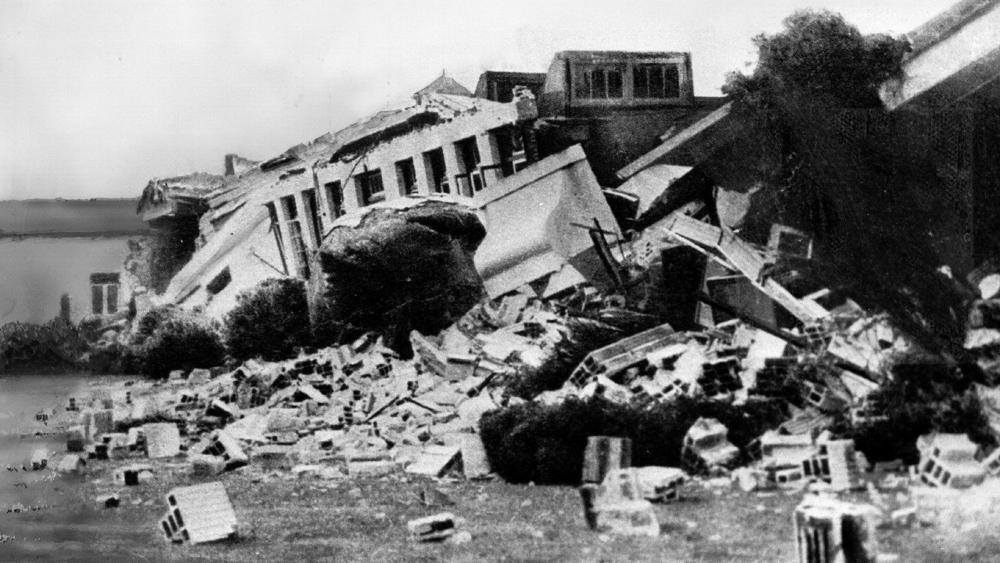
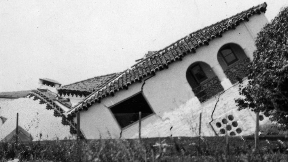
A few visuals of frac-related quake damages:

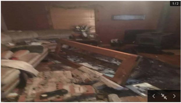
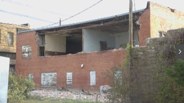
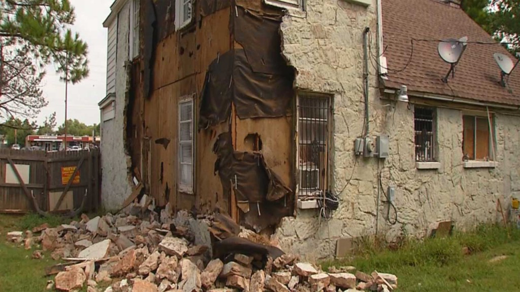
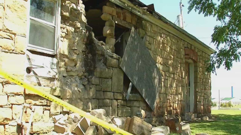
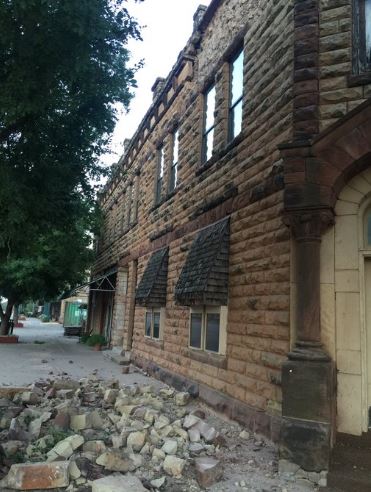

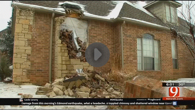
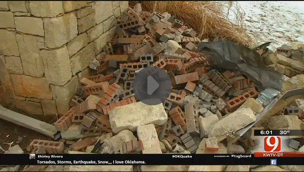

New study: Hydraulic fracturing volume is associated with induced earthquake productivity in Duvernay play, Fox Creek Alberta Ryan Schultz was part of this study.
Another Study! Federal and provincial scientists, BC OGC and AER Prove hydraulic fracturing directly caused (August 17, 2015) 4.6M frac quake in NE BC Ryan Schultz also part of this one.
Sure, roll out the traffic lights for us rural guinea pigs!
“It’s pretty unlikely these events would have been felt at the surface,” said Barter. “If anything, it would have been close to a rumble under your feet, like a truck driving by.”
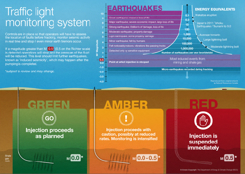
UK, which ceased frac’ing because of the frac quakes:

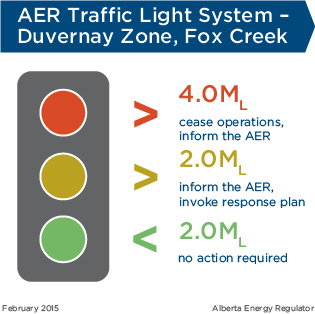
Compare to Alberta, full steam frac ‘n quake ahead:
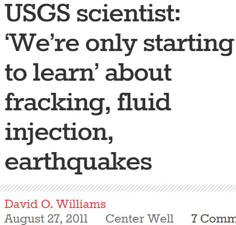
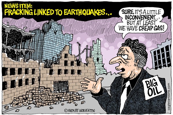
Sneaky buggers! The 272 earthquakes found by Canadian regulators to have been directly caused by hydraulic fracturing, officially reported in August 2012, are excluded, as well as the many caused by frac’ing in the USA to mid-2011, long before this map was created. Why are only the quakes caused by Cuadrilla in the UK included on the map?
Why are authorities hiding that hydraulic fracturing (not just waste water injection) is directly causing earthquakes?
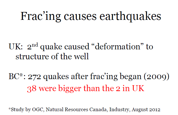
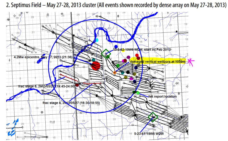
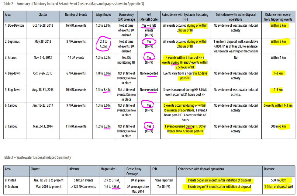
BC frac quakes also caused deformation to energy well bores, as in the UK
Investigation of Observed Seismicity in the Horn River Basin
2000: Seismicity in the Oil Field
The gas field was discovered in 1956 and production began in 1962. Over the next 14 years, roughly 600×106 m3 of water, or 106 ton per km2, were injected. …
Beginning in 1976, a series of large earthquakes was recorded. The first significant earthquake occurred on April 8, 1976 at a distance of 20 km [12 miles] from the Gazli gasfield boundary. The earthquake magnitude measured 6.8. Just 39 days later, on May 17, 1976, another severe earthquake occurred 27 km [17 miles] to the west of the first one. The magnitude of the second earthquake was 7.3. Eight years later, on March 20, 1984, a third earthquake occurred 15 km [9miles] to the west of the second earthquake, with a magnitude of 7.2. … Aftershocks occurred in a volume surrounding the three hypocentres. These earthquakes are the strongest of all the known earthquakes in the plain of Central Asia. …
There was no clear relationship between the location of the earthquake hypocenters and any previously known active tectonic structures.
Closer investigation showed that the earthquakes had created new faults.
… In all these cases, the result of human interference was to change the state of stress in the surrounding volume of earth. If the stress change is big enough, it can cause an earthquake, either by fracturing the rock mass—in the case of mining or underground explosions—or by causing rock to slip along existing zones of weakness.
The situation in regions of hydrocarbon recovery is not always well understood: in some places, extraction of fluid induces seismicity; in others, injection induces seismicity.
… Even minor actions can trigger strong seismicity.
… The amassed data indicate that the Gazli earthquakes were triggered by the exploitation of the gas field.
… In regions of high tectonic potential energy, hydrocarbon production can cause severe increases in seismic activity and trigger strong earthquakes, as in Gazli, Uzbekistan.
In regions of lower tectonic stress, earthquakes of that magnitude are less likely, but relatively weak earthquakes could occur and damage surface structures.
