
Many landowners in Alberta call the Farmers’ Advocate Office the Oil & Gas Friendly Farmers’ Advocate and the Surface Rights Board the Oil & Gas Friendly Surface Rights Board.
Canada’s regulators and courts are oil & gas friendly too, as are our environmental NGOs.![]()
British Columbia’s Surface Rights Board’s File Collection by Petroleum Company by Will Koop, BC Tap Water Alliance, Nov 9, 2020

Image: Ovintiv’s (EnCana’s) recently built farmland fracking ‘water resource’ hub in the Peace River Agricultural Land Reserve, located at intersection of Mason and 212 Roads, the site of a former tank explosion event in the Greater Farmington area.
A self-funded project by Will Koop
B.C. Tap Water Alliance (www.bctwa.org)
email: email hidden; JavaScript is required
(Posted) November 9, 2020
| Documents * British Columbia’s Surface Rights Board’s File Collection by Petroleum Company introduction (PDF, 3 Mb) * Links to Petroleum Company Document File Collections * Table of Petroleum Company Files (PDF, 60 Kb) *Collection of All Petroleum Companies Images (PDF – 37 Mb) |
The B.C. Surface Rights Board
Following revisions to British Columbia’s (BC’s) Petroleum and Natural Gas Act (PNGA), the Mediation and Arbitration Board (MAB) was renamed the Surface Rights Board (SRB) in 2010. [“The Board re-designed and re-worded its website, to provide more user friendly and detailed guidance to the public, especially landowners who are not familiar with how to prepare for a Board proceeding. The development of this new website was put on hold until next fiscal year, due to budget constraints and due to the proposed amendments to the Petroleum and Natural Gas Act (which should be reflected in the website).” Quote from the Surface Rights Board 2009-2010 annual report.]
On October 4, 2010, the “[Surface Rights] Board launched its new website.” [Source: Surface Rights Board 2010-2011 annual report.]
The SRB website has hyperlinks to accumulated quasi-legal hearing and decision file documents from the years 1999 to the present, and links to annual reports dating from 2004 to the present. Pre-1999 file documents were not digitized by the SRB and are only available for hard copy inspection at the SRB’s headquarter office.
The SRB’s website file collection (post 1998) spans some 21 years. It provides limited, yet valuable insights on some of the traumatic struggles associated with the source problem: industry and development-oriented legislation that still legalizes almost unfettered access to, manipulation of, and cumulative toxic fracking-related pollutions and seismic events to private and lease lands in northeast British Columbia. These scenarios are set within a wider problematic context of successive government administrations which have systematically ignored and rejected, for more than forty years, implementation of meaningful cumulative effects policy and law, particularly as it relates to the recent unbridled boom of vast provincial land sale parcels for unconventional petroleum fracking (gas, oil, liquids) sources.
Reorganization of SRB’s File Collection (for the purposes of easier review)
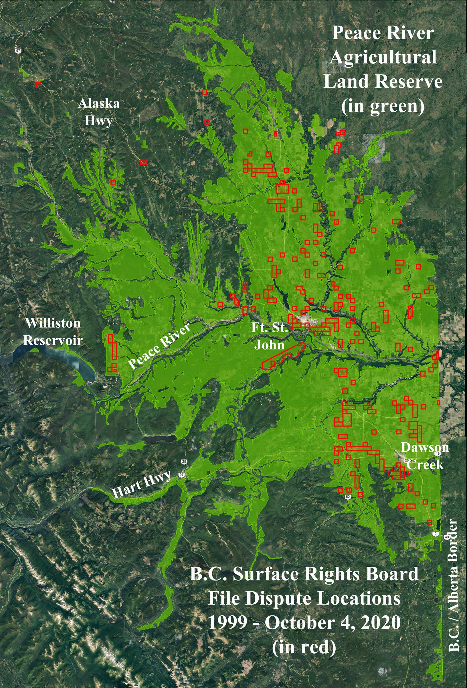
All the SRB’s 560 document files related to petroleum (oil and gas) industry Surface Rights Agreement disputes with landowners and agricultural businesses in northeast BC’s experimental and controversial fracking zone were downloaded in early October 2020. The steps taken included reorganizing SRB files into annual bulk collections, 1999 to 2020, for easier analysis. The next step included making the SRB’s PDF formatted documents, most of which were not word searchable, searchable.
From these annual collections, a master file database was created inside a GIS (Geographic Information System) software vector-based attribute or spreadsheet table. This database provided a powerful and easy way to analyze the complex information from which strategies were developed to organize helpful or simple structured themes.
The petroleum company theme presents an easier tool for free public use and scrutiny. As a result, sequentially numeric files were merged as single PDF documents under the names of individual companies.
Petroleum companies, including their names and assets, come and go, and some are acquired by other companies and corporations. Some go bankrupt and leave their costly liabilities and messes behind for taxpayers to mop up!
[Peace River Agricultural Land Reserve image above: much of BC’s petroleum (oil and gas) land tenures are oddly licensed and located within the Peace River Agricultural Land Reserve (ALR), an immense area. Within the ALR is where almost all the Surface Rights Agreement conflicts registered with the Surface Rights Board are located, set within a growing, vast web of fracking-sourced petroleum infrastructure.]
Creation of Merged Location Maps and Google Earth Images
Because the SRB fails to provide to the public contextual location imagery and maps for each of its landowner and land access dispute files, maps were specially created to show and identify the specific land location parcels (Township Sections and Quarter Sections, District Lots, etc.) within the Peace River Regional District’s immense Agricultural Land Reserve (ALR) grid. The ALR (see image above) is situated north and south of the Peace River, generally overlying what geologists refer to as northeast British Columbia’s Montney Formation.
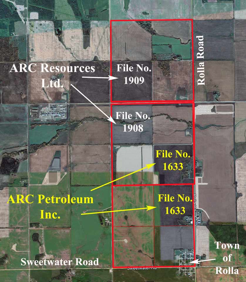
Individual and cluster boundaries of these company land dispute locations were merged onto Google Earth satellite imagery. The images were then transferred to photo editing software to label and identify company / corporate names, document file numbers, location identifiers, etc. After editing 216 images, they were merged into the individual company PDF collections under file document numbers. A separate Google Earth image collection PDF document showing all the 216 images was also created for public use. Added imagery was also created for this introduction.
The red outlined squares in the image to the right, which are labelled on the Google Earth images, represent a Township “Section” of land. A “Section” is 640 acres, or 259 hectares, in total area.
Insights: Patterns and Analyses
This complex undertaking on reorganizing the SRB’s documents can aid northeast BC citizens, the interested public and aspiring researchers with a new integrated advantage to better understand and observe, including birds-eye imagery perspectives with company theme collections, where some of the hundreds of land conflicts have occurred over time in northeast BC’s harmful fracking legacy.
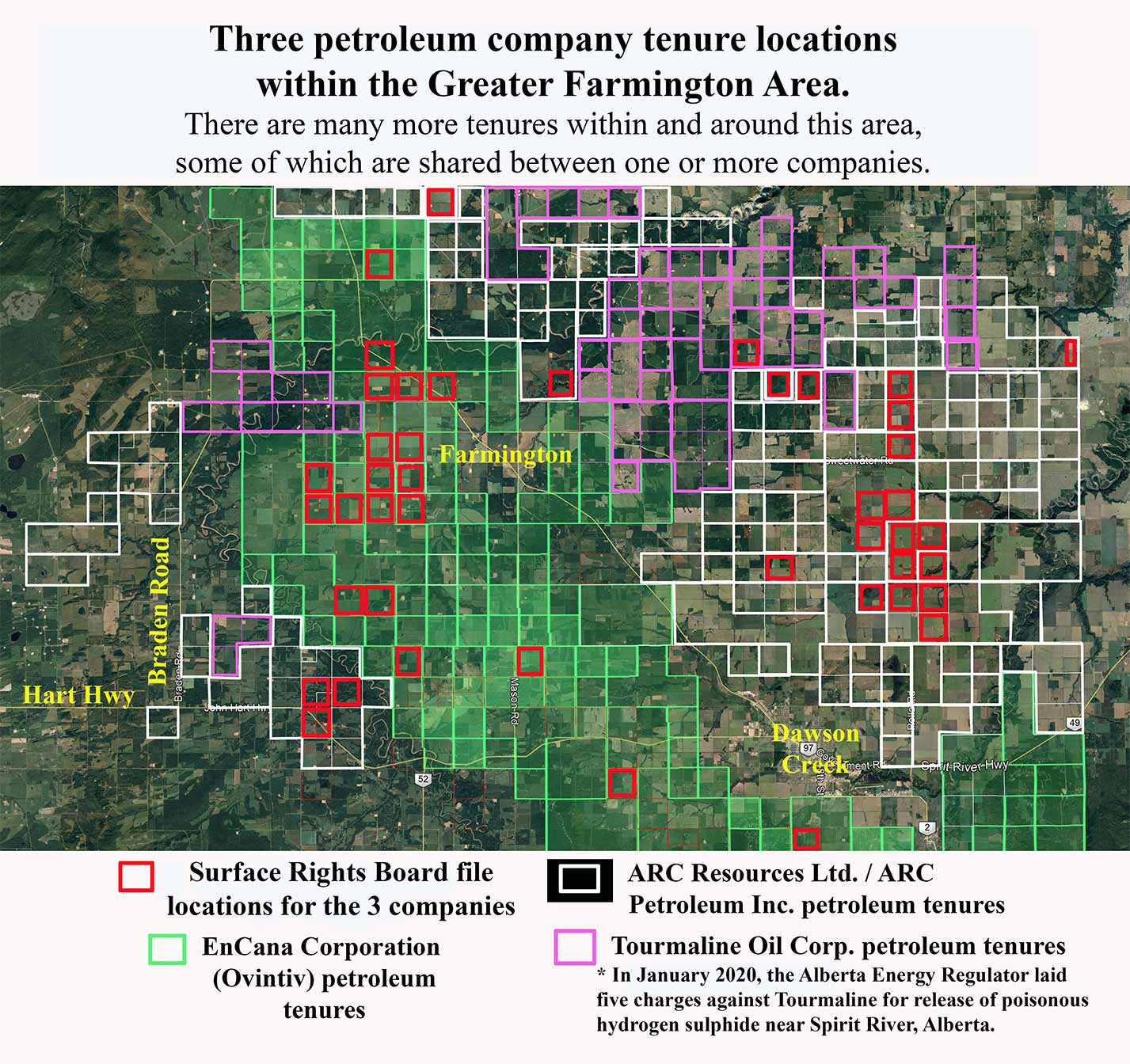
1. Greater Farmington Area: In the Agricultural Land Reserve zone sandwiched between Dawson Creek and Ft. St. John (within what I have named the Greater Farmington Area) are a significant number of document file conflicts, particularly with two of the bigger corporations: ARC Resources Ltd. with 31 files, and EnCana Corporation (EnCana recently changed to Ovintiv) with 52 files. EnCana’s land dispute reputation and aggressive style amongst Albertans, Saskatchewanians, northeast British Columbians, and with landowners in the U.S.A. is richly notorious, as is reflectively evident by way of the sheer number of accumulated SRB file documents. This is also true with respect to the BC Oil and Gas Commission’s Tribunal, where individual EnCana / landowner dispute file documents represent almost half of that collection to date (20 out of 52 decisions, from 2011 to 2020) alone. [Refer to the website – www.ernstversusencana.ca – for numerous accounts of EnCana / Ovintiv. Also, Andrew Nikiforuk’s books, Saboteurs (2002) and Slick Water (2015). In late 2008, in the Tom’s Lake area, south of Dawson Creek, following bombing incidents of EnCana’s infrastructure, both EnCana and the RCMP conducted round-the-clock surveillance, intimidation and interrogation of the ‘locals.’]
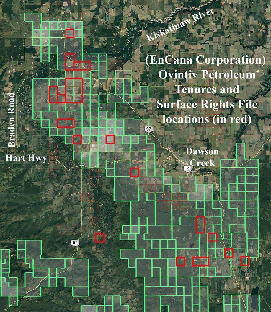
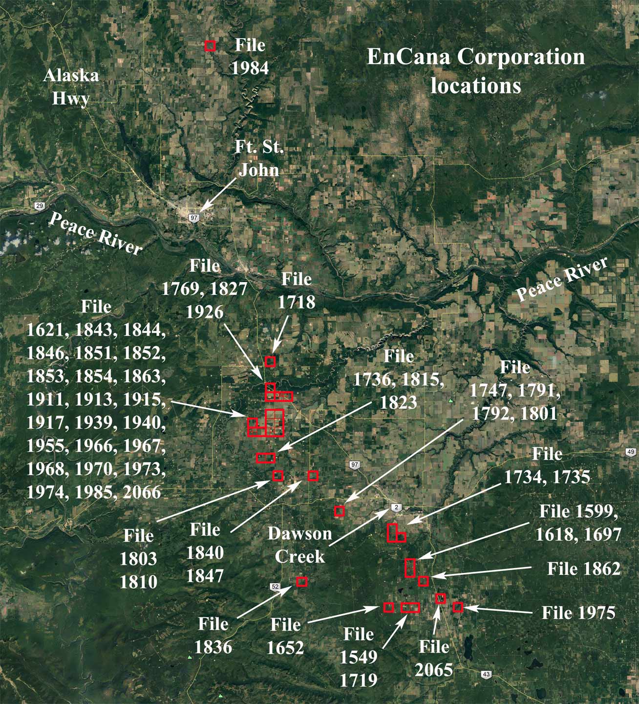
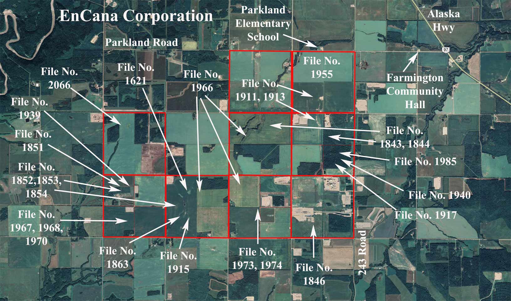
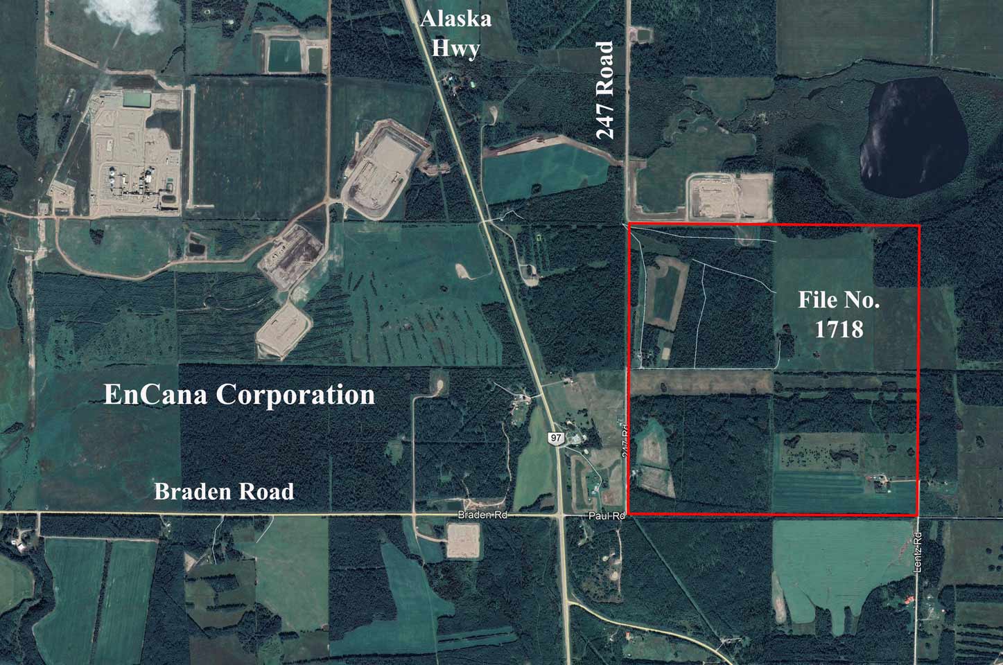
Above and below: sample images found in EnCana Corporation’s (Ovintiv’s) file collection.
2. Rental Agreements: SRB file documents, from 2018 onward, indicate a new trend, particularly with two companies, Ranch Energy Corporation (95 file documents) and Predator Oil BC Ltd. (25 file documents). The trend shows the companies’ failure to honour rent payment contracts with landowners. These, as witnessed in Alberta and Saskatchewan, show companies opting out of their contracts with landowners, townships and municipalities, leaving costs and abandoned infrastructure for taxpayers.
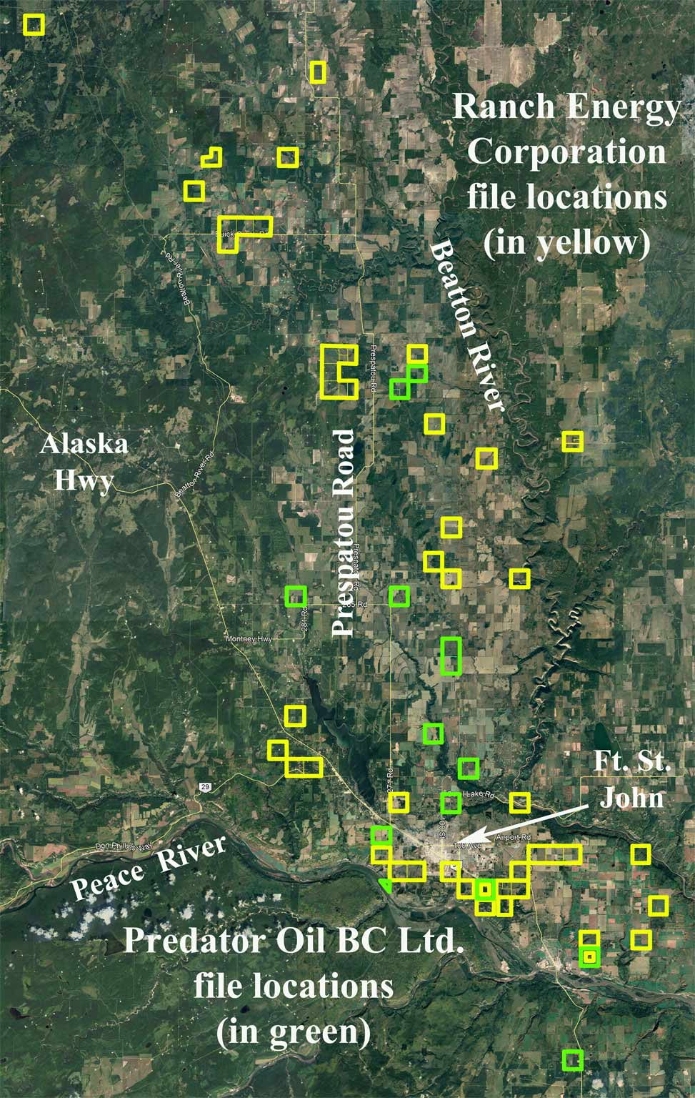
SRB’s Ranch Energy file collection finds that the company, which went into receivership in July 2018, and filed for bankruptcy in mid-2020, failed to pay out a total of $581,517, not including accrued interests. The files note 15 instances of Ranch Energy being delinquent in payment for two years running, and one instance of failing to pay for three years running. The bankruptcy resulted in 401 ‘orphan’ wells and 3 abandoned facilities. Media articles report that Predator Oil BC Ltd. sold many of its properties to Ranch Energy Corporation. (Search online with “The Narwhal” for information on Ranch Energy. In Narwhal’s March 12, 2019 article, “Predator is still listed on the BC Oil and Gas Commission’s website as the permit holder for Ranch operations”.) It was elsewhere reported that Erickson National Energy Inc. acquired numerous oil and gas wells from Ranch Energy.
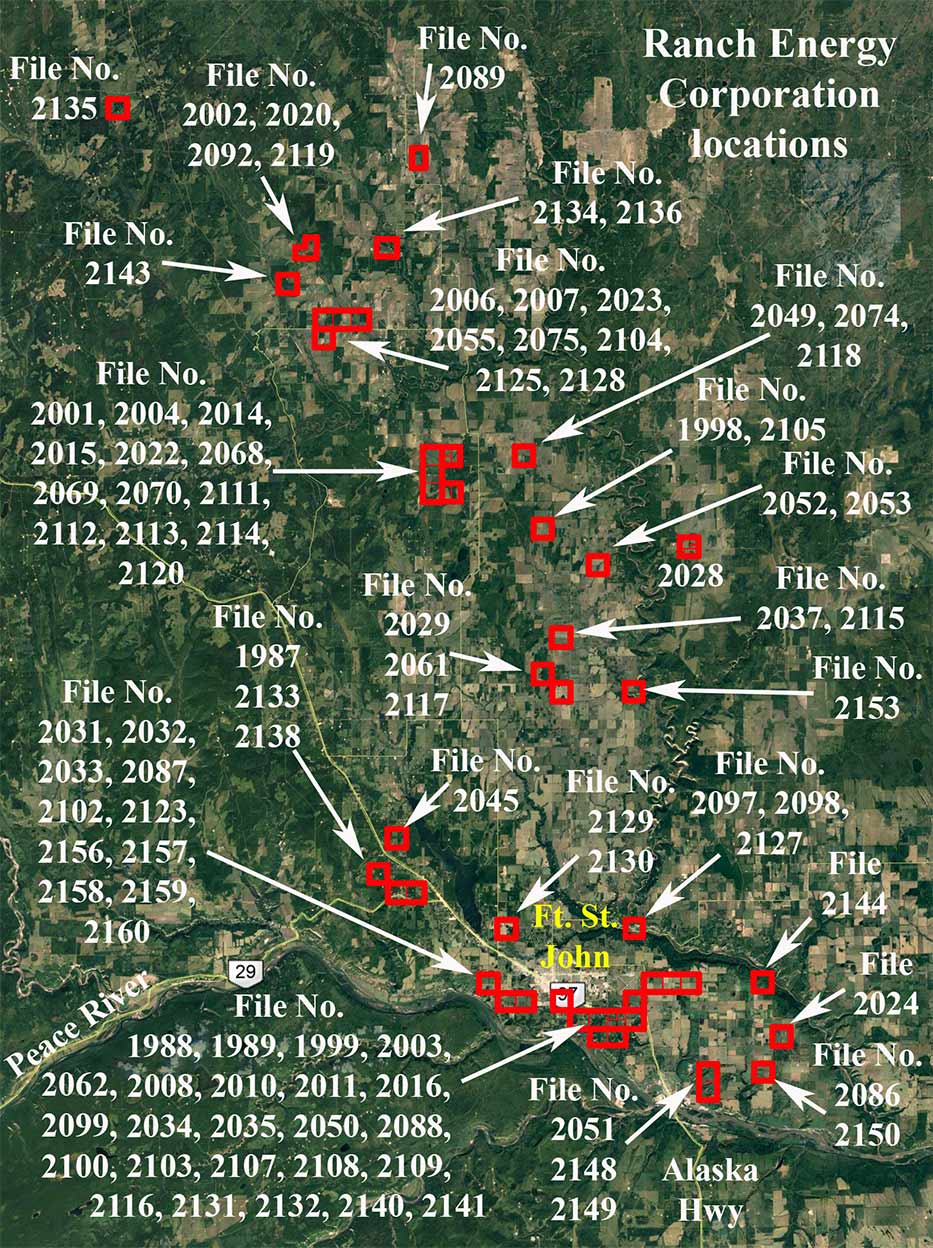
Image above: now bankrupt Ranch Energy Corporation and SRB’s file collection numbers and locations, north of the Peace River.
SRB’s Predator Oil BC Ltd. file collection finds that the company failed to pay out a total of $99,958.50, not including accrued interests. There were 2 instances of Predator Oil being delinquent in payment for two years running, and one where it was delinquent in payment for three years running. Predator Oil BC Ltd. was incorporated in BC on February 27, 2017 (amalgamated with incorporation number C1109158) and registered in Alberta on December 9, 2016. Predator Oil BC Ltd. is now affiliated with Highwood Oil Company, founded by Predator’s former CEO and board director, Joel MacLeod, who is also the CEO of Predator Midstream Ltd. (registered in Alberta).
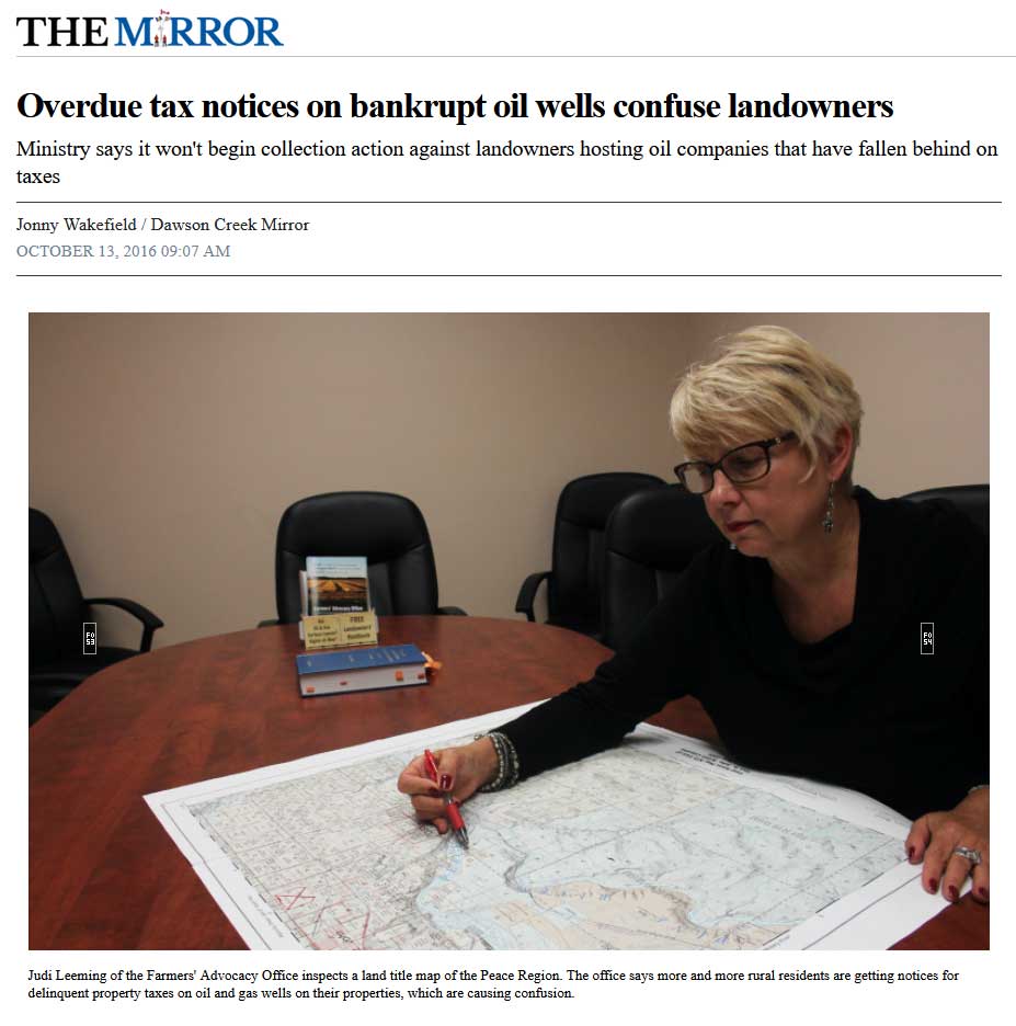
Above: October 13, 2016, The Mirror news article photo showing the now defunct BC Farmers’ Advocacy Office with a working copy of a large government map, whereon staff marked for identification the delinquent petroleum company conflict area locations with red outlines and boundaries.
Conflicts
The SRB documents fail to illuminate what affected landowners thought about industry’s plans and intrusions when negotiating Surface Rights Agreements. However, the documents provide a strong whiff of how citizens remain troubled and opposed to industry’s cumulative intrusions.
The public rarely gets to see long-term corporate strategies for development that transform rural, agricultural and wilderness landscapes into integrated industrial complexes. These are morally controversial strategies which are usually hidden from local landowners.
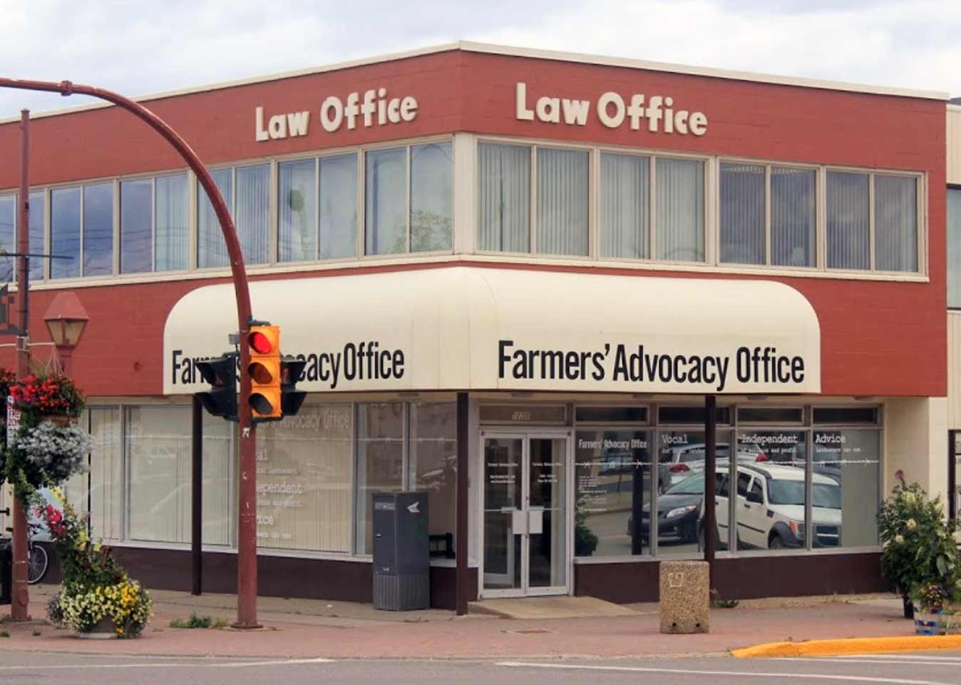
Most of the company land conflicts in the Peace Regional District’s Agricultural Land Reserve are settled in secret, confidentially. Some are openly settled by way of the SRB, some by way of the BC Oil and Gas Commission’s Tribunal. Since its operations began on October 7, 2010, the Peace River area Farmers’ Advocacy Office was an important intervenor in the SRB’s hearings, an Office and website now sadly defunct.
The Farmers’ Advocacy Office advised citizens of their legal rights and conducted related research on their behalf (i.e., as described in the March 25, 2011 edition of Pipeline News North article, Farmer’s Advocacy Office). In Alberta, farmers nicknamed the Farmers’ Advocate Office, the “oil and gas friendly Gas Advocate.”
Secret deals and financial settlements sometimes involve land rights / land sale transfer strategies agreements: a said company employee or affiliate becomes the new owner; a disputed parcel of that land parcel is then used, now without conflict and onerous consent, to construct facilities and wells, etc., without rental agreements; and the other parcel of said land and structures are rented out, and later resold with all the environmental damage as ‘fait accompli.’
These, and other secret financial deals often lead to neighbor and inter-family conflicts and distrust, intense or otherwise, in the general ‘community,’ including First Nations, where companies set up shop. A given company’s interests is to pit one person against another, one community against another, to succeed in ‘divide and conquer.’ The financial and political stakes are high and ruthless. That is why, tragically, amidst other reasons, many Peace Country residents have moved out to escape the conflicts and environmentally invasive and toxic conditions. Others stay behind, shut up, put up with the harms, take the money, and others support industry.
